Area Target recognition up to simultaneous 5 targets.
Please provide your development details as below;
1. SDK Version: 6.1.0
2. Development Environment: Unity-Android, Unity-IOS
3. Tracker/Scanner: SpaceTracker
4. License Type(Free / Pro-One Time Fee / Pro-Subscription / Enterprise): Trial
In the latest update to your SDK (6.1.0) it's mentioned that it supports up to 5 space area targets instead of 1 on the previously version of the SDK.
In my particular case, I need to develop a navigation application for a museum that is larger than 20x20 square meters and I was wondering if it was already possible with 6.1.0 to use multiple space area targets so it would be possible to join multiple scans.
In the collection of examples from the Unity package, I have not found any examples of how that multiple space area target recognition can be done.
I've gone through your documentation (https://developer.maxst.com/MD/doc/6_1_x/unity/ex/space#section) and I know about the mention to the use of the tool application "Map Packager" and I've succesfully packed together multiple scans:

But aside from the previous space tracking example, that is working fine in my side, I have no idea how to create a Unity scene so I organize the whole multiple scanned area targets to work.
Please, could it be possible to know if there will be any Unity example in order for programmers to understand how a system with multiple area targets in the same scene can work anytime soon?
Hello.
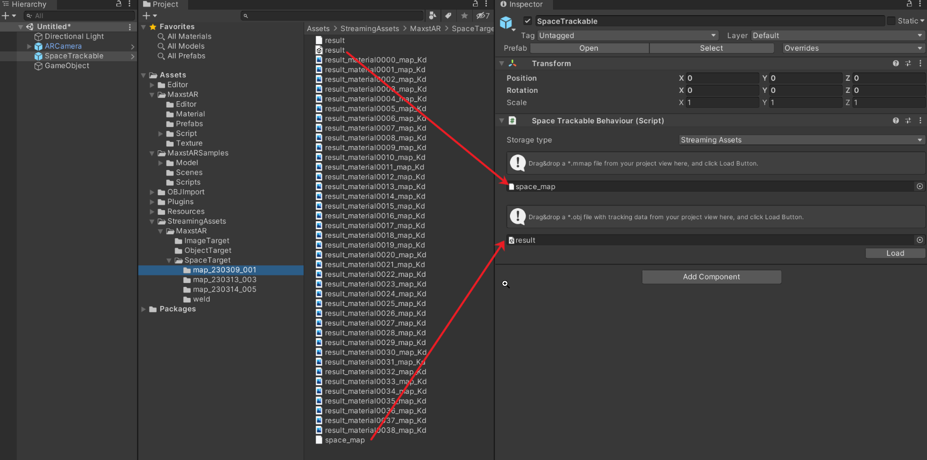
To use a package file, you need to do something like the image below.

First, when you create the package, make sure that all of the files that have been trained are named differently.
Create an empty GameObject under the SpaceTrackable and rename it to the name of the training file. The meshes from the training file can be loaded using the Load button.
Place the mesh under the GameObject you created for authoring and author the content as you wish.
* The reason for renaming the empty GameObject is that when you create the package, the name of the training file will appear in the Update function as the tracking progresses.
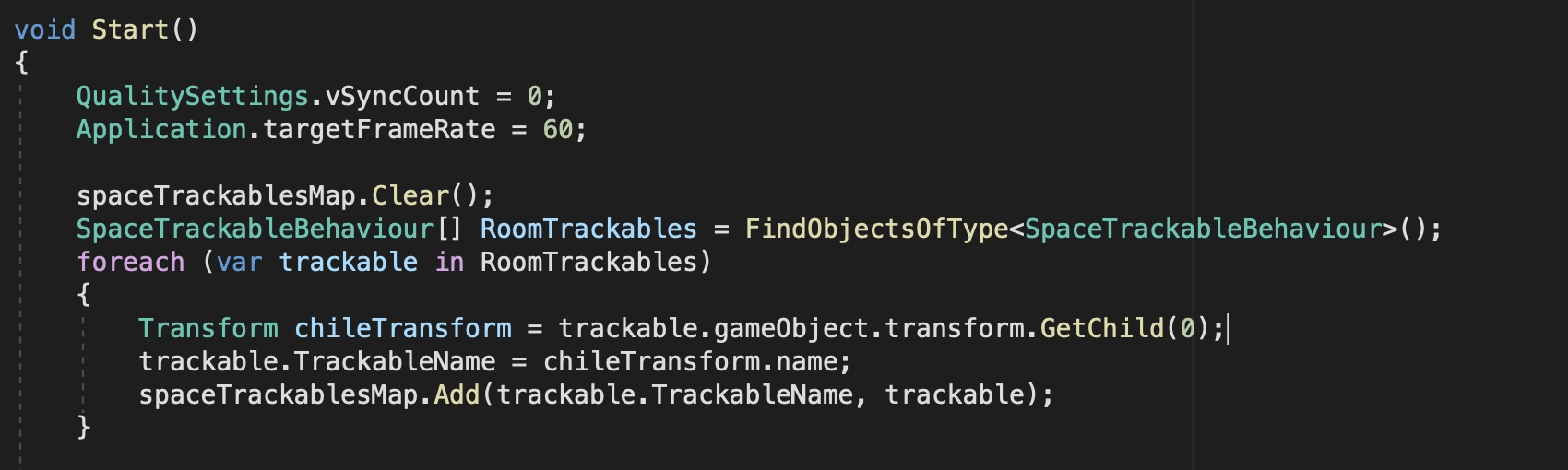
In order to load content for Trackable, we need to modify the following code of the Start function.
To load the packaged file, we need to modify the AddTrackerData function as shown below.
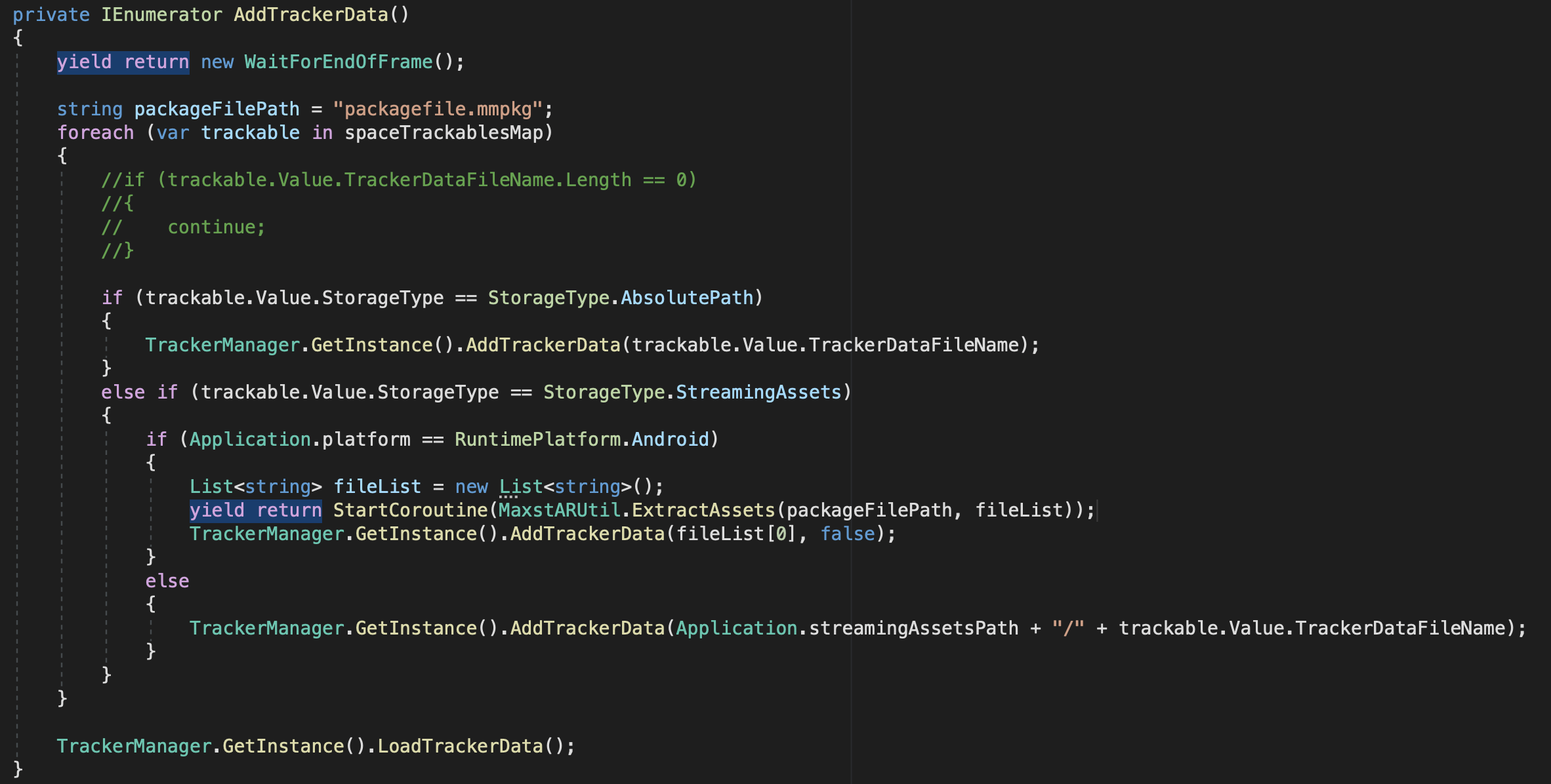
After making the above modifications, you should now be tracking for the map names you have learned.
Keane
MAXST Support Team
Thank you a lot!! My dream of AR navigation in an area of 1000 square meters seems to become a reality!!!
Hello,
This last month I've been trying to implement the system to recognize multiple areas at the same time but so far I've not been able to succeed. Is there any chance that you could include a sample scene in the SDK examples so I can properly follow the right structure?
Thanks,
Esteban