MAXSCAN
MAXSCAN is an application that scans a three-dimensional space based on a LiDAR sensor to generate spatial maps and manage generated spatial map files. After scanning a space, you can use the preview feature to place sample AR content on top of the scanned spatial map, point the camera at the location where you placed the AR content, and watch the AR content augment in that location.
Developers can use the generated spatial map data and MAXST AR SDK to quickly and easily develop AR/VR services in a single step.
Note
- MAXSCAN app can only be used with SDK version 6.1.x or later.
- MAXSCAN is only supported on iPhone/iPad devices equipped with a LiDAR scanner. It will not work on unsupported devices.
Download
You can download MAXSCAN app at Download > Tools > MAXSCAN.
1. LiDAR/Room Scan
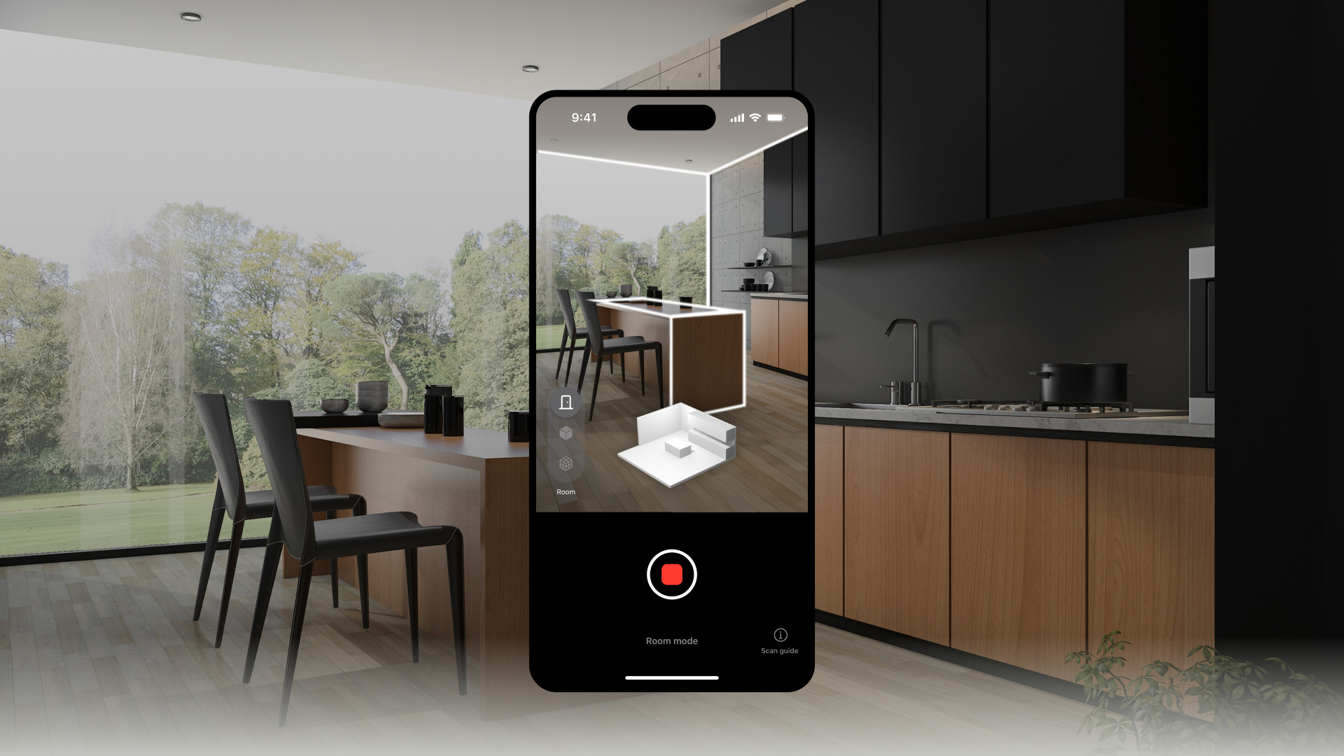
- You can use an iPhone or iPad with LiDAR capabilities to scan your space.
- Move the camera slowly to scan.
- Check where you've shot in wire/solid mode and move slowly in a steady position to scan. Create a mesh with sharper textures.
- Good for scanning large objects like rooms.
- Smaller objects, thin objects, and transparent or reflective objects may not be scanned. When scanning a room, you'll get a higher quality texture if you scan facing the walls.
- Avoid scanning the same area repeatedly.
- Recognition rates and texture quality can decrease. It's also a good idea to plan your path before you scan.
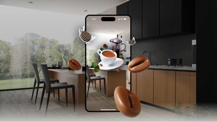
2. AR Preview
- After scanning the space, select the AR content that is sampled on top of the scanned spatial map through the preview, then move/rotate and resize it to place it in the desired shape.
- When the camera recognises the space and shines on the AR content, you will see the AR content augmented in that location.
- You can check the recognition of the scanned space by shining the camera on the spot where you placed the AR content.
3. Upload the spatial map
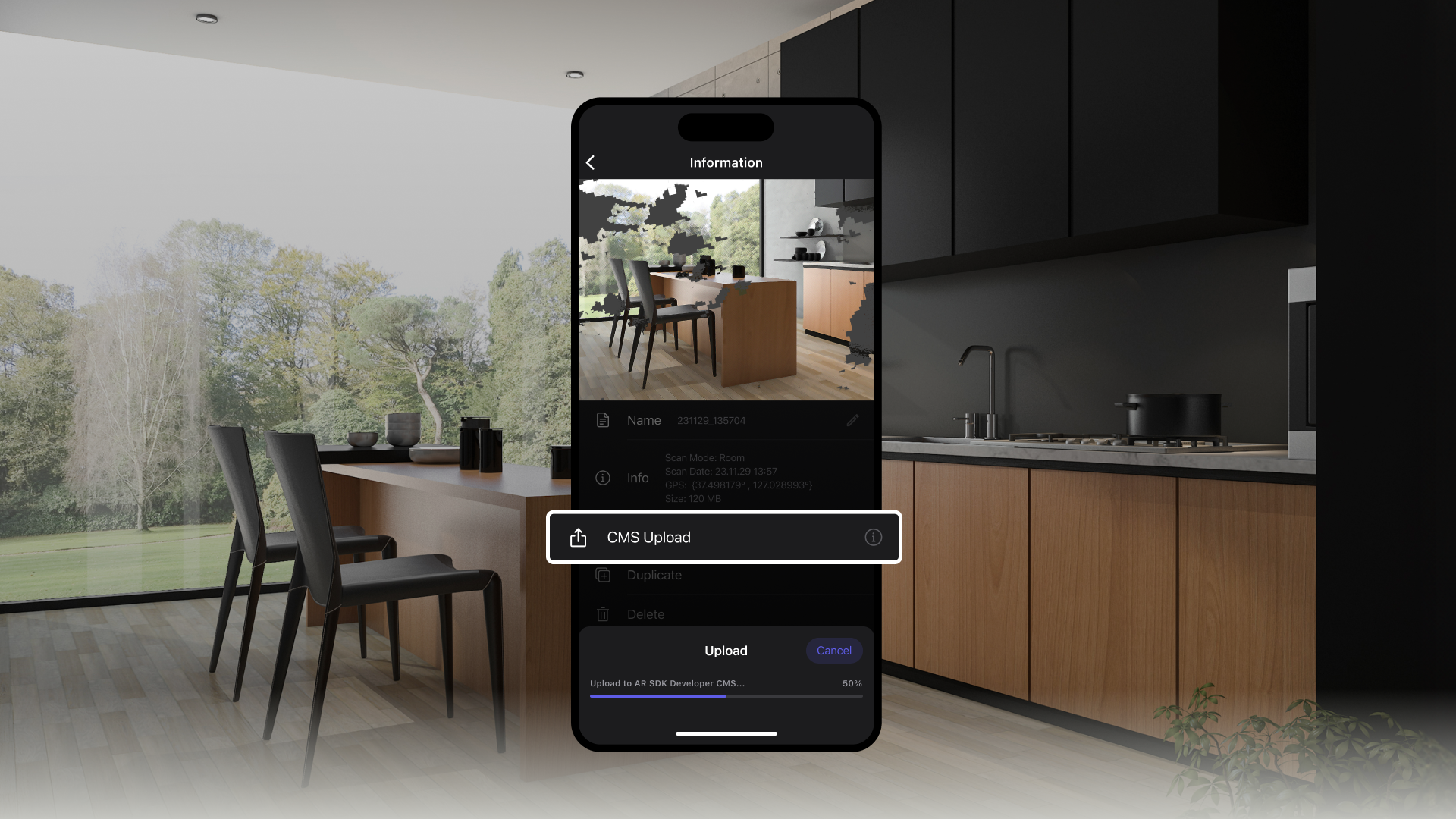
- Check the scanned spatial map and upload it to the MAXST developer site.
4. Download the SDK and spatial maps
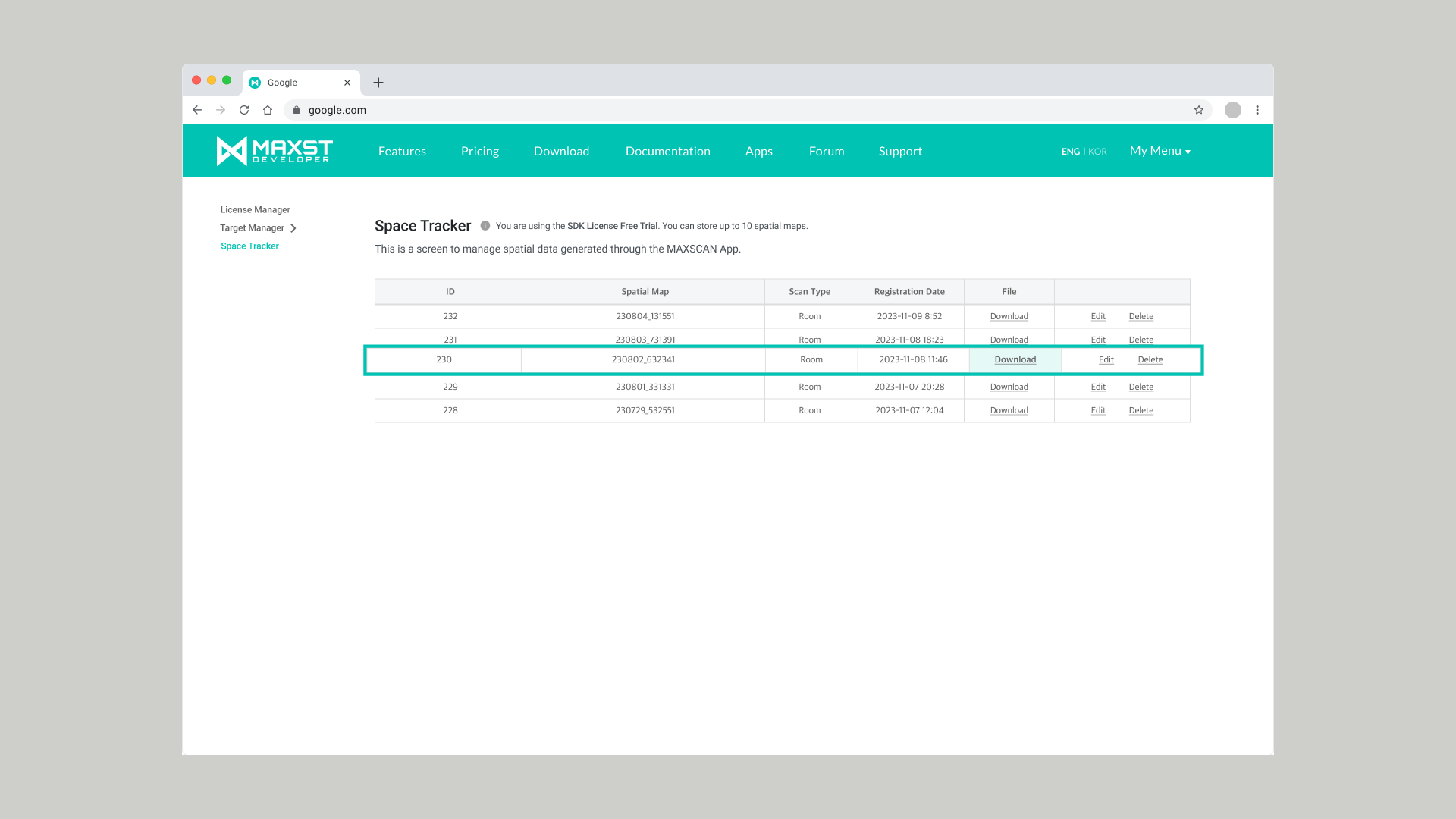
- Log in to the MAXST developer site (https://developer.maxst.com)
- Download the SDK of your choice: Unity, Unity for Nreal, Android, or iOS.
- Download the spatial map you uploaded from the Space Tracker menu in My Menu.
5. Develop & Build
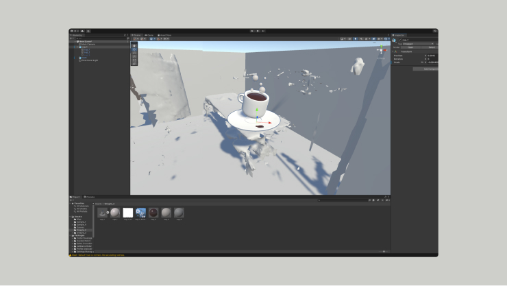
- Load the downloaded spatial map in your development environment, place the desired content, and build it.
Note
- Development guides can be found in the Documentation on the MAXST developer site.
6. Launch your AR service
- After running the app you built, it will recognise the target space and view the augmented content.
Tips. In Room mode, you can customise the texture of your Mesh.
- With Room mode, you can select wall-by-wall in a scanned space and change the texture of the walls with any image or color of your choice, or use the inpainting feature to reconstruct parts of the wall that are covered by objects and not scanned.
Note
Supported Device List
Manufacturer Supported Device List Apple iPad Pro 11 (2nd generation), iPad Pro 12.9 (4th generation), iPhone 12 Pro, iPhone 12 Pro Max, iPhone 13 Pro, iPhone 13 Pro Max , iPhone 14 Pro, iPhone 14 Pro Max, iPhone 15 Pro, iPhone 15 Pro Max